GIS
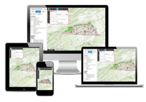
GIS is critical in centralizing collected data, whether it is institutional knowledge, on paper, digital maps or in databases. This data can range from cadastral information, design mapping, utility modeling, geotechnical information, inspections, work orders, GPS field collection or any other location based items. It facilitates easy access to this information which allows for custom analysis and reporting. Accessing through a mobile device ensures this data can be viewed almost anywhere.

Our Services Include
Asset Management & Analysis
Asset Collection Methods
Budget Cost Analysis
Database Design & Reporting
Overall Infrastructure Health
Planning Support
Site Selection Analysis
Tourism & Economic Development Mapping
Utility & BIM Mapping
Utility Modeling
Consulting
GIS Deployment
GIS Needs Assessment
GIS Training
GIS Implementation
CAD Plans to GIS
Custom Tool Development
Data Editing & Conversion
Database Management
E911 Addressing & Verification
Error Correction
Field Collection Data to GIS
Paper Maps to GIS
Parcel Mapping & Mapbooks
Software Compatability
WebGIS
Customizable
Expert Assistance
GIS on Any Device
Multiple Use Applications
Public & Secure Access
Reliable Technology
Save Time & Money
Use Your Server Infrastructure
